As the summer creeps ever closer, the outdoors blossom back to life. Pennsylvania boasts thousands of acres of beautiful forests, sprawling with hiking trails and full of opportunities to witness unforgettable natural views without traveling across the country or even all the way across the state. Whether you’ve sought out these sights for years or have only recently discovered an interest in the outdoors, Pennsylvania parks and trails can fulfill every kind of need.
Laurel Highlands is an ideal option for all kinds of outdoor interests. A massive region of 100,000 acres, composed of eight state parks and two state forests, the area offers almost every outdoor activity imaginable. From intensive biking trips to waterfall views in just one easy mile, Laurel Highlands truly has something for everyone.
Of the eight state parks, Ohiopyle is the best known and the most diverse. It houses the Great Allegheny Passage, an impressive 150-mile trail that connects Pittsburgh to D.C. through a series of bike paths. Though the GAP is the best known part of Ohiopyle, the large state park has much more to offer than just bike trails. The Youghiogheny River, which course through the village of Ohiopyle, is available for activities from intense whitewater rafting to family floats, alongside kayaking and canoeing opportunities.
It also contains an entrance to the Laurel Highlands Hiking Trail, one of the best trails for long-term backpacking trips. This 70-mile trail runs from Ohiopyle to Conemaugh Gorge, open year-long and carefully managed. Eight different night shelters are scattered throughout the trail, approximately every six to twelve miles. If you’re not ready to commit to the full 70 miles, the trail is easy to exit through dozens of interconnected trails in several of Laurel Highlands parks, making it an ideal outing for beginner backpackers. Backpacking trips as short as a single night can be easily accomplished on the LHHT, or you can simply hike for a day and return without spending any nights. The trail peaks at 2,961 feet of elevation and passes through a variety of iconic Laurel Highlands locations.
Other popular difficult Laurel Highlands trails include the McCune Trail, the Baughman Trail, Lake Trail, and the Sugarloaf Trail System. While these trails are recommended for more experienced hikers, a diverse set of trails for any range of age and ability is available in Laurel Highlands.
Beam Rocks, a short one-mile but moderate hike that includes an incredible overlook, is a personal favorite. It is accessible both through the LHHT or outside of it in Forbes State Forest. The Adams Falls hike in Linn Run State park is another moderate one-mile trail with sights of a mountain waterfall that weaves between impressive boulders. For an easier hike, Forbes State Forest’s Cole Run Trail is just two miles long and provides a view of the sparkling Blue Hole Creek. Alternatively, Ohiopyle’s Meadow Run Trail is a very easy three-mile hike that offers a view of the park’s cascading Cucumber Falls.
McConnells Mill State Park is significantly smaller than the vast region of Laurel Highlands, but its 2,564 acres pack an impressive amount of enjoyable hikes and other opportunities. Hikes of a vast array of difficulty levels are spread throughout the park’s 11.2 miles of trails, including a backpacking trail.
Its Hells Hollow Trail, an extremely easy half-mile route, was one of my first hikes and a reason I fell in love with the outdoors. The simple trail is level and boasts stunning views of Hells Hollow Falls. If you’re interested in traveling through more diverse terrain, the more difficult Breakneck Falls Trail allows you to climb through steep boulders along the path, ultimately rewarding you with another gorgeous waterfall view. The Slippery Rock Gorge Trail is a 6.2 mile backpacking trail that runs from Hell Run Valley to the Walnut Flats, providing a diverse range of sights for one of the best local beginner backpacking trails. The Slippery Rock Gorge Trail was my first backpacking trip, and one that I cannot recommend highly enough. There are also a couple of worthwhile rock climbing opportunities present in McConnells Mill, Rim Road and Breakneck Bridge.
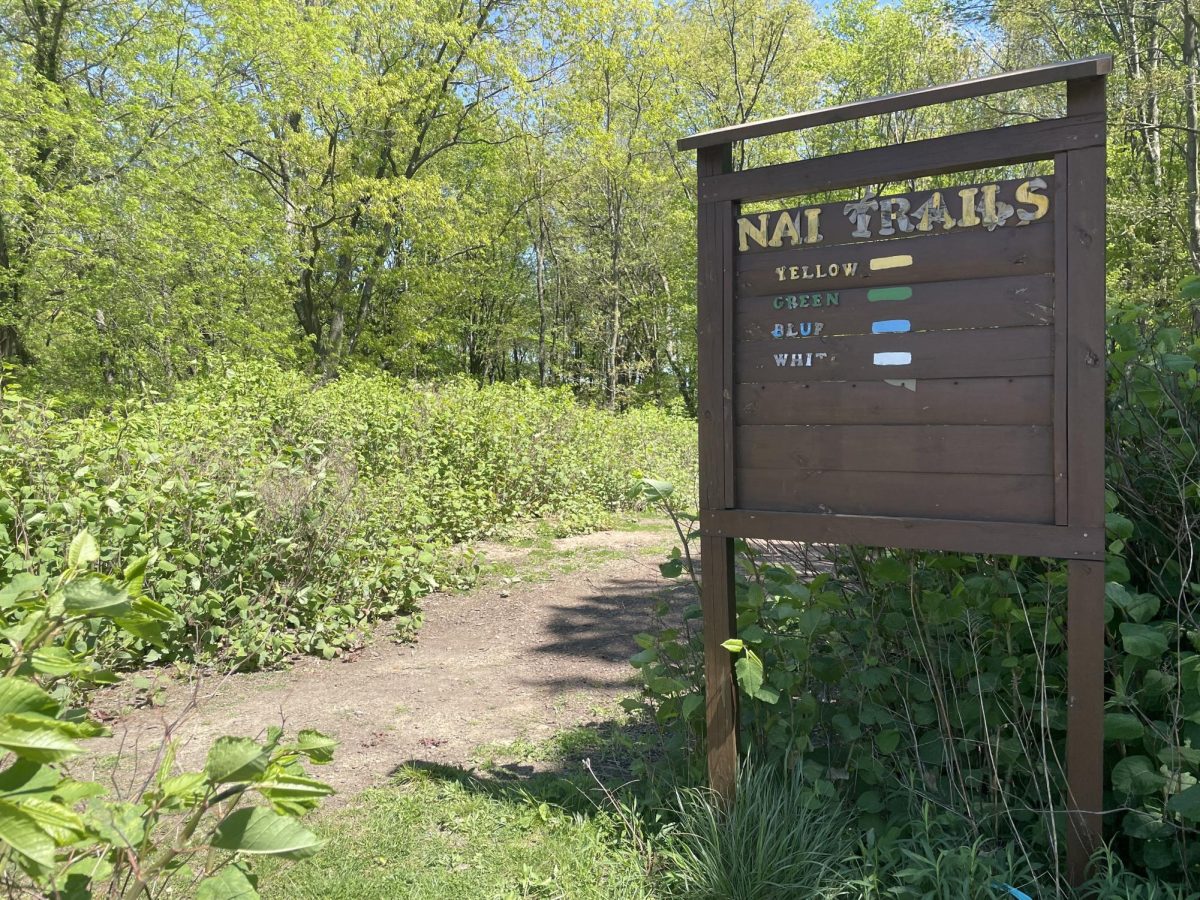
For those looking for something more familiar, or just something more local, a sprawling network of trails link McKnight Elementary, Carson Middle School and NAI through entrances found behind each school. These trails are heavily interconnected and marked primarily through white, blue, and green tree tags, though some marked trails have been altered by fallen trees and shifting streams. These trails are all relatively short in length and can be easily followed. Most pathways are wide enough to be safely biked through, and a short paved trail found just behind McKnight is an option for additional accessibility.
It is important to note that these trails are North Allegheny School District property and cannot be accessed between 7 AM and 4 PM. Interested hikers should also be mindful of any school events that may cause restricted trail access outside of these hours. As they were all designed for students, the trails are easy to traverse and intended for short time periods, making them ideal for anyone brand new to hiking and interested in exploring the sport.
Whether you’re an experienced hiking enthusiast or have never before walked through the forest grounds, the outdoors beckon. Every trail starts with a single step forward.


